Camping Maps and Trails
Camping:
- Black Woods- open all year long, located in a spruce forest near seashore just off state highway 3. May-Oct. reservations recommended fee $30 per site per night. November and April weather permitting fee $10 self registration. Dec.-Mar. limited number of campsite available the fee is free.
- Seawall Campground- open late May-Sep., located on route 102A, fee $22 for a walk up tent, $30 for drive up tent and camper.
- Schoodic Woods Campground- In 2015 open September through Columbus day, located Schoodic Peninsula. Fee $22 for a walk in tent, $30 drive up tent/small RV, $36 RV with electricity, and $40 RV with electricity and water.
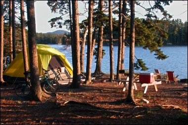
Black Woods Camp site
Maps:
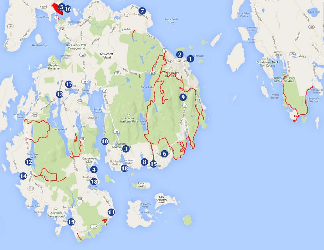
Places to go:
1) Walk the Bar Harbor Shore Path
2) Walk on the Bar in Bar Harbor at low tide
3) Visit the Asticou Azalea Garden and hike up to Thuya Garden
4) Walk across the Causeway in Southwest Harbor
5) Walk the Trenton Community Trail
Hike the Northeast Harbor town trails
7) Walk down Hadley Point
Hike at Blagden Preserve at Indian Point
Explore a Maine Coast Heritage Trust Preserve
8) Walk or run the privately-owned carriage roads at Little Long Pond (no bicycles allowed)
9) Route 3 from Bar Harbor to Northeast Harbor
10) Sargent Drive
11) Route 102A past Seawall to Bass Harbor
12) Seal Cove Pond
13) Long Pond
14) the Seal Cove boat landing
15) the beach at Seal Harbor
16) Lamoine State Park
18) Take the ferry to Little Cranberry Island and have a picnic on the beach
19) Take the ferry to Swans Island and go for a bike ride
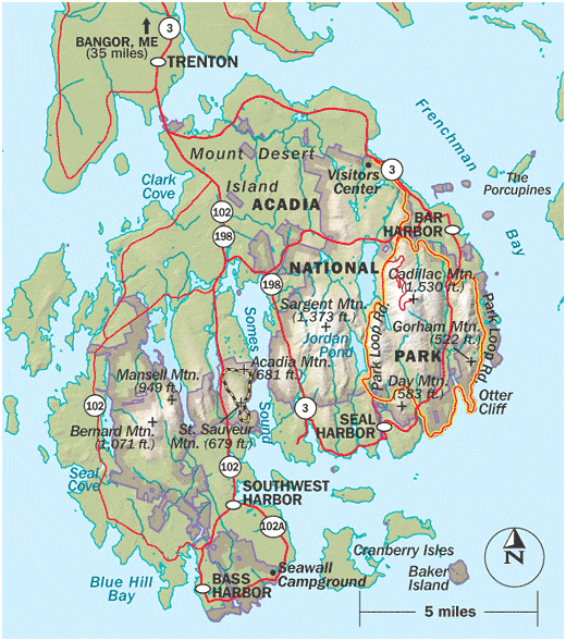
Mountains and roads of Acadia National Park
Trails:
125 miles of hiking trails. Large parts of the park's loop road are closed down for the winter season. 45 miles of gravel roads are only open by foot, bicycle, and horse traffic.
Difficulty Level:
Very easy- Smooth path, level ground
Bar Harbor shore path; 1 mile
Ocean trail; 3 miles
Cadillac Summit; 0.3 miles
Wonderland; 1.4 miles
Jordan Pond Nature Trail; 1 mile
Easy- uneven but fairly level
Bar Island; distance varies
Ship Harbor Nature Trail; 1.3 miles
Most Carriage Roads; distance varies
Moderate- some steep some level
Beech Mountain Trail; 1.2 miles
Champlain Mountain; 2.2 miles
Bowl Trail; 1.4 miles
Gorham Mountain Trail; 1.8 miles
Bubble Rock Trail; 1 mile
Great Head Trail; 1.4 miles
Cadillac Mountain North Ridge Trail; 4.4 miles
Jordan Pond Shore Trail; 2.5 miles
Strenuous- Steep, grades
Acadia Mountain Trail; 2.5 miles
Beehive Trail; 0.8 miles
Cadillac Mountain South Ridge Trail; 7.4 miles
Champlain Mountain; 2.4 miles
Dorr Mountain; 4.8 miles
Mansell Mountain; 2 miles
Norumbega Mountain; 1 mile
Pemetic Mountain Trail; 2.4 miles
Precipice Trail; 1.6 miles
